


What Swash did
- Swash undertook a comprehensive desktop investigation to determine the need for sediment removal through dredging or bed-levelling.
- Swash provided a final report and presentation material for Gold Coast Waters Authority (GCWA) board and management.
- The aims of this investigation were to:
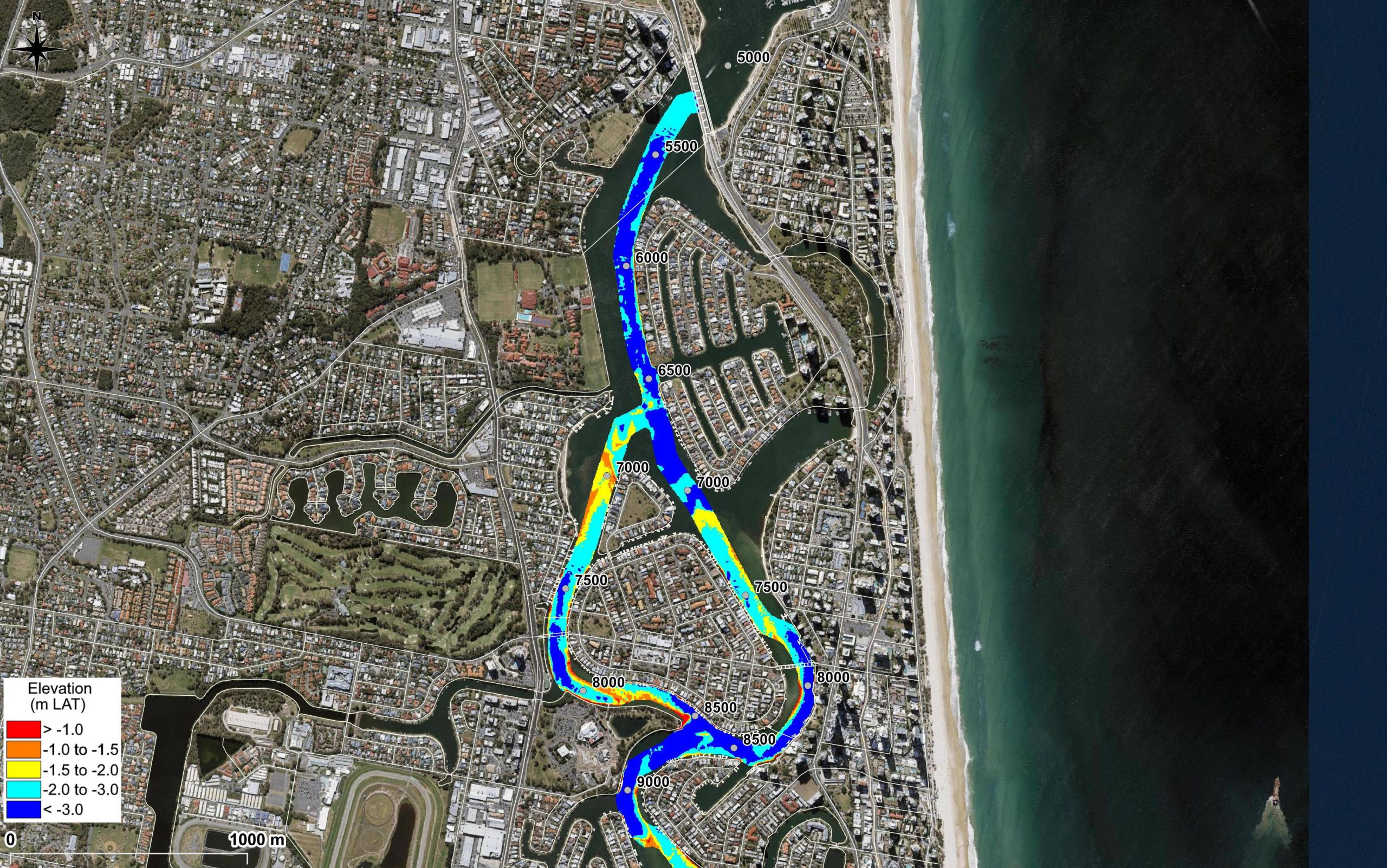
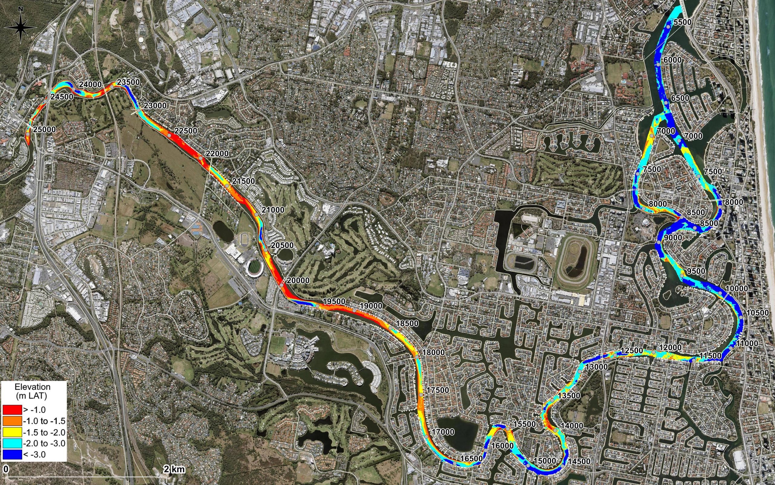
- Determine the extent of shoaling with respect to current target navigable depth of -1.0m LAT
- Review existing demand (waterway usage, boating infrastructure, large vessels)
- Review existing reports of shoaling (incidents and community feedback)
- Assess dredging requirements if navigable depths were increased to -1.5m and -2.0m LAT
- Provide summaries on proposed dredging and placement methodologies
- Provide an understanding of project planning constraints and approvals
- Provide a high-level assessment of potential environmental impacts and risks
- Provide recommendations on the need for dredging, or otherwise, and any additional studies that would be required.
About the project
The Nerang River Catchment downstream of the Pacific Highway (Nerang) is referred to as the lower catchment. This catchment is low lying and contains a number of different canal networks and minor tributaries. Most of the area is also tidally affected.
A ‘target’ navigable depth of -1.0m LAT and 40m channel width was adopted in this section of the Nerang River based on the 2010 Access Needs Study (TMR).
Gold Coast Waterways Authority required a dredging investigation brief to be prepared to inform future decision making.


